Andalucia Impressions: walking in Andalucia - our top ten walks, 5th to 1st
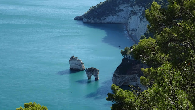
5. Sendero de los Acantilados
de Barbate
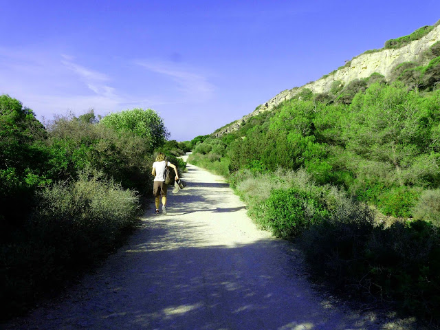
You can do the path in
either direction from Caños de Meca, or from Barbate through the barbate
Natural Park. We stopped at the first official car park for the walk going from
Barbate towards Caños de Meca. The path at the beginning is a dirt road through
the pinewood with glimpses of the sea.
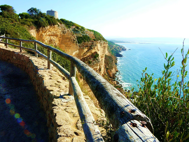
At Torre del Tajo the views of the 90m high cliffs below and on both sides where there's the Sendero Mirador are spectacular. The path continues down towards Caños but gets progressively sandier which makes for harder going. A relaxing walk, quite a few people around, trainers are sufficient or walking sandals. Once in the pinewood it’s shady but the first part from the Barbate side car park along the track has no shade. This was our day.
At Torre del Tajo the views of the 90m high cliffs below and on both sides where there's the Sendero Mirador are spectacular. The path continues down towards Caños but gets progressively sandier which makes for harder going. A relaxing walk, quite a few people around, trainers are sufficient or walking sandals. Once in the pinewood it’s shady but the first part from the Barbate side car park along the track has no shade. This was our day.
4. San Jose – Playa Monsul
You can park at the start
of the road to Playa Genoveses and follow the path, which goes past a windmill
then through a sort of forest of agave before reaching Playa Genoveses itself between
two headlands. The path then continues, sometimes signed in blue and white but
always obvious. Sometimes there are different options but just follow the
coast, as close as you like for comfort.The type of rock changes continuously, every
so often there is a spectacular cove, sometimes the sand is darker. At one
point the path is cut into the rock, but around the next corner you start to
descend towards Playa Mosul on the warm dunes. The path is not difficult but in some points the terrain
below the path is quite steep so bear this in mind if you’re afraid of heights.
It’s nothing dangerous but you need to watch your step. Once again, proper hiking boots with a good sole are advisable.
You can also get to Playa
Monsul by car, park and then continue up on the Sendero Vela Blanca, originally
designed to be a road to continue all around the coast to the Cabo de gata
lighthouse but now closed to traffic. This is easy walking on a wide track, big
enough for a car. You can go as far as the tower or continue down the other side to the lighthouse. This was our day.
3. Garganta Verde
We did the Garganta Verde
path on 16th October. It is closed during the summer due to fire risk and this
was the first day it opened after. You need to get permission to do this path
and we did that by email.By writing a simple email in Spanish they sent us a
form to fill in, once again in Spanish but if you have some basic knowledge or
use Google translate it's no problem and then they sent us the permission. This
saves having to go to the visitor centre, we met some people on the way up who
had spent a long time waiting there. The email address is: cvelbosque@reservatuvisita.es
On Google maps, to find
the start you must put "Sendero Garganta Verde" not just
"Garganta Verde" which takes you to the wrong place. The start is on
the mountain road between Grazalema and Zahara de la Sierra, nearer to Zahara. You mustn't go if rain or
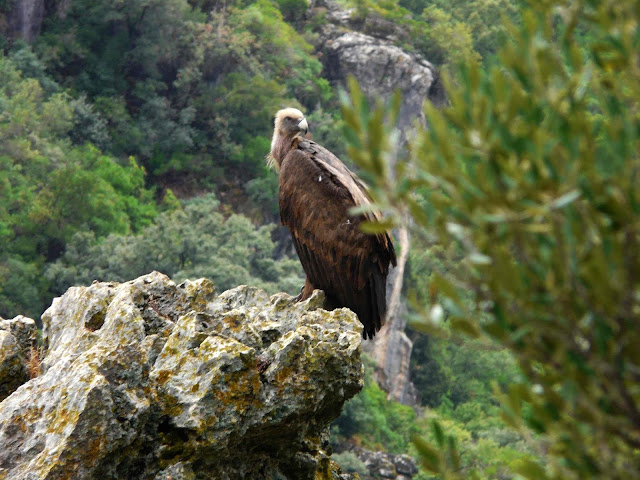
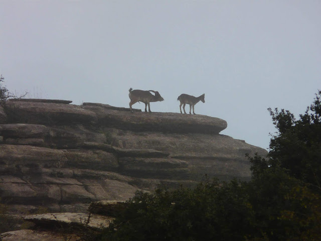
bad weather is forecast, we set off on a cloudy morning and were the first
people about so were lucky to see the vultures and some wild goats.
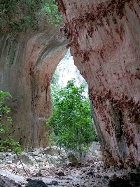
The path isn't difficult but you need hiking shoes with a good sole because it can be slippery and at the stream bed you have to do some scrambling over rocks. If you're used to hiking and are fit this is no problem. The cave is SPECTACULAR. If you like hiking and nature and are in this area I strongly advise you to do this trail. It's a good idea to go to Zahara after which is just a few minutes by car and is splendid. This was our day.
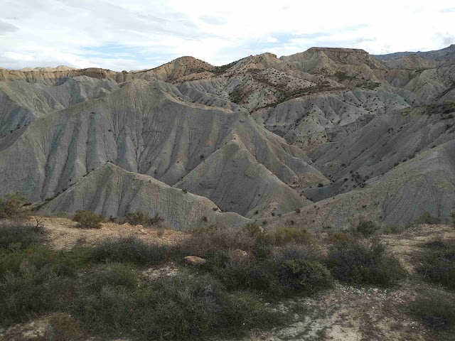
2. Tabernas Desert
Another unique
environment, the only desert area in Europe. We found a ten kilometre route on
Wikiloc which took us on a round trip up and down the bare and rocky valleys
and hills starting from the car park and ex-visitors’ centre near Oasys Mini
Hollywood. There were some paths signed starting from there too. We saw just a
family at the very start of the route, a group by jeep with a guide halfway
through and nobody else. Very lonely places with a stark beauty and fascinating
rock formations. Proper walking shoes are advisable, ironically in a desert
area it had rained and since part of the route is near a ‘dry’ stream bed, it
can be quite muddy. Take enough water and food because there is absolutely
nothing – splendid! This was our day.
1. El Torcal
The Torcal Natural park
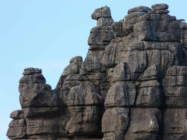
near Antequera is a spectacular and unique landscape of rocks eroded into
bizarre and beautiful shapes which allow your imagination to run wild. From
Daleks to masked men, from biscuits to sombreros, nature has carved the rocks
as if it knew the shapes to make.
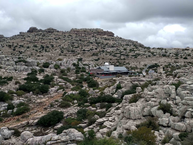
The Torcal Visitors centre is about 30 minutes by car from Antequera, there is a large car park, a cafeteria, toilets and information about the two marked routes available, which you can also find here: http://www.torcaldeantequera.com/rutas/rutas-uso-publico/ . The two paths start off from the car park, a little before the visitors centre, on the right when you arrive by car. The green route is the shortest and takes about 45 minutes, that’s considering you will be spending a lot of time standing still in wonder or taking photos. The yellow route officially takes about two hours. We did a combination of the two plus a detour in about two hours.
If you want to see more the Park offers guided tours, or if you are used to walking in nature and have a reasonable sense of direction have a look at Wikiloc for some ideas…..There is also the orange route up from the lower car park. We spent a whole day and an extra morning there in the end. The Torcal Park is different from anything I’ve seen before and is definitely worth a visit. We were there end October and the car park was pretty full about lunchtime. Most people stick to the green or at the most the yellow route but go early in the morning if you want some peace and quiet and to see the mountain goats. Good walking boots are advisable, the limestone terrain is uncomfortable for the feet with small rocks and stones and very slippery and muddy if it’s rained. This was our day







Comments
Post a Comment